
Walk a Yolo Street by Address
A Yolo street directory search works best as a chain of stable keys. Begin with the exact street string, find the parcel or assessment account, and record the APN. Then move to the public GIS layer, the Assessor’s permitted owner and mailing fields, the recorder’s party index, and only after that the voter or historical sources. The sequence matters because the county tax site does not publish owner names online, the recorder is not street-address indexed, and the voter file is restricted by purpose. An address is the starting point, not the name of a complete household.
Each step answers a different question. GIS can locate the polygon and neighboring parcels. The assessment roll can identify an assessee and tax-mail address through the counter or limited phone service. A deed identifies parties to an instrument and a legal interest. A directory or census entry can show a person printed at an address during a particular year. None of these labels should be silently changed to “resident.”
- Run a narrow street-address search in the Yolo ACE / MBAP property search. The portal accepts fee parcel, assessment, or street address and works better with a short address string.
- Copy every APN and confirm the situs in the county GIS service. At a corner or multiunit parcel, preserve the unit and legal-description clues.
- Ask the Assessor counter or limited phone line for owner, mailing address, latest document, and assessment fields where the permitted channel allows it.
- Search the recorder as grantor and grantee, using document type and date. An instrument, lien, reconveyance, or notice is not automatically a transfer.
- Use the California voter channel only for an authorized purpose, then consult Woodland directories, census schedules, or Sanborn sheets for past address context.
Yolo Street Records at a Glance
The Yolo street directory is a useful phrase for a reader, but the underlying sources have different keys and limits. The tax portal and GIS service accept an address or parcel clue. The assessment roll is available through the counter and limited phone route. The recorder searches names, document numbers, types, and recording dates rather than browsing a street. Municipal permit pages depend on whether the parcel sits in Davis, Woodland, West Sacramento, Winters, or unincorporated Yolo.
| Record Set | Keeper | What It Shows | Access |
|---|---|---|---|
| Tax lookup | Yolo Assessor | Street, APN, assessment account | Free web search; no owner name |
| Assessment roll | Yolo Assessor | Assessee, mailing address, values, exemption, latest document | Counter or limited phone |
| GIS parcel layer | Yolo County GIS | APN, situs, lot, acres, jurisdiction, adjacent polygons | Free map and REST service |
| Deed index | Clerk-Recorder | Grantor, grantee, type, date, instrument or book/page clue | Free index; images and copies vary |
| Permits and code files | City or county | Project dates, status, applicant or contractor where public | Jurisdiction-specific search or request |
| Historical directories | Yolo County Archives | Printed names and addresses for selected years | Reading room; gaps are documented |
The APN is the main bridge between an address and land records. Carry it into the Assessor conversation, then use the latest recorded document to begin a name-keyed deed search. A permit may show a date or project without identifying a household. A directory entry may show a past address without proving ownership. This is why a street-by-street worksheet should keep a source column and a clear “not found” note.
Yolo Street Property Search Starts with an APN
The public Yolo property search is designed for parcel discovery. Its Search By control offers FEE PARCEL, ASSESSMENT, and STREET ADDRESS. The Search Term is required, and the county’s captured instructions set a two-character minimum and twenty-character maximum. For a street query, omit the road type and use a compact compass direction. Broad strings can produce noisy results or exceed the result limit.
The search result is only the first half of the property trail. The official ownership page says the public web view omits the owner name even though the complete roll contains assessee, mailing address, land and improvement values, homeowner exemption, latest recorded document, revenue district, and net taxable value. Residential characteristics such as year built and square footage are a separate counter item with a listed $6.75 per parcel charge.
| Yolo field | Type | Required | Format or use |
|---|---|---|---|
| Search By | Choice | Yes | Fee parcel, assessment, or street address |
| Search Term | Text | Yes | Two to twenty characters; narrow the street text |
| Street Address | Text value | When selected | Omit Street, Road, Drive, or Lane; abbreviate N, E, S, W |
| Search | Button | Action | Returns parcel or assessment matches |
Use the Assessor’s ownership explanation before treating a public result as a name search. The county’s limited phone service answers current owner, owner mailing address, APN, latest document, and assessment questions for no more than three parcels per call. Keep the street worksheet parcel by parcel.
The captured Yolo assessment-roll view shows which fields belong to the counter record rather than the web search.
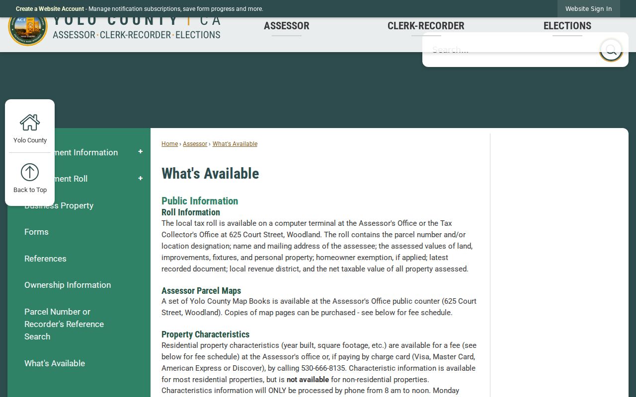
That distinction prevents a missing web name from being mistaken for a missing county record.
Yolo Street GIS Opens the Adjacent Parcels
Yolo County GIS is a cooperative program with Davis, Woodland, Winters, West Sacramento, and SACOG. The public parcel service exposes APN, situs, lot, acreage, jurisdiction, land use, district context, map year, revision date, and related parcel fields. The county documents parcel, zoning, land-use, supervisorial, fire, school, and FEMA flood-context layers. Parcel lines may not align exactly with every aerial, Census, or flood layer, so use the map as location evidence and keep the source revision in your notes.
To browse a Yolo street, search or zoom to the target address, select its polygon, copy the APN, and click each surrounding polygon in turn. Record the situs, postal community, incorporated municipality, and jurisdiction. A parcel owner is not automatically a person who lives there, and one parcel can contain several households. GIS is strongest for structure and boundary context, not for a people list.
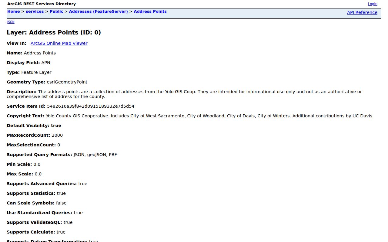
The public parcel layer can be queried free of charge, with a 2,000-feature service limit noted in the research. The county’s address-point service adds postal and USPS verification fields. Those two layers let an address-based Yolo street directory search test whether the tax result and mapped situs agree.
The county’s GIS program page explains the cooperative layers behind the public map. The parcel layer screenshot below is a source view for that APN-to-polygon step.
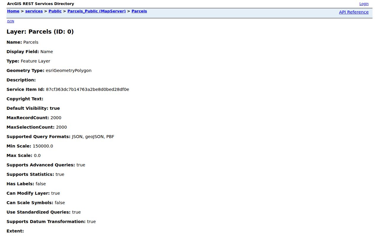
After the polygon is confirmed, carry the APN to the Assessor and recorder rather than trying to read an owner from the map alone.
Yolo Street Deed Chains Cross the 1970 Divide
The recorder’s index is a name and document trail along a Yolo street, not an address browse. Search both grantor and grantee roles, add document type and recording date, and preserve the instrument number or book/page reference. A deed, deed of trust, reconveyance, lien, or notice has a different meaning. The index locates a document; the instrument supplies the legal description and the capacity in which each party signed.
Yolo’s online coverage needs a careful note. The Recording page says grantor-grantee access begins in 1960. The Online Services page describes 1970-present, and the copy workflow uses September 4, 1970 as the practical cutoff between book/page references and instrument or document numbers. Use remote search for the newer range, then call or visit the Clerk-Recorder for 1960s material and earlier books. Office records reach back to 1850.
For a street directory worksheet, move from APN to the latest recorded document, then from current owner as grantee to the earlier seller as grantee. Carry the legal description, subdivision, lot, and block because the address can change while the land identity remains. The official recorded-document search guidance lists grantor or grantee, document number, type, and recording-date modes.
The Yolo ownership-information page explains why the name handoff occurs at the counter or through the limited phone route.
Before ordering a document, review the county’s recording overview, the online-services description, and the official-record fee schedule. Those pages help separate an index hit, an office copy, and the fee for certification or other record service.
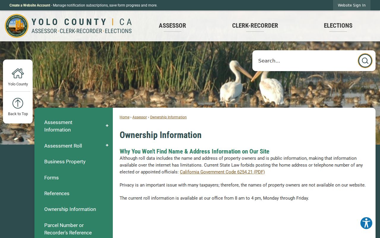
Use the ownership field only for the scope the Assessor confirms, then return to the recorder for the instrument chain.
Yolo Street Permit Trails by Jurisdiction
Permit records can add dates to a street history. Woodland’s public inquiry accepts permit number, application date, street address, and status, with Pending, Issued, Approved, Final, and All choices. West Sacramento’s Citizen Access home exposes Building, Business License, Code Enforcement, Engineering, Fire, and Planning modules to anonymous users. Davis building records are requested through Community Development at 23 Russell Boulevard, Suite 2, and county addresses use Community Services when they are unincorporated.
A permit identifies a project, not necessarily a household. The applicant may be an architect, contractor, agent, or owner. Approved plans or supporting material in West Sacramento can require a CPRA request, and stamped plans may have copyright limits even when viewing is arranged. Code cases can be incomplete or restricted. Treat the date and status as evidence of work, not as a label for a person.
Woodland’s search screen is useful for a narrow address query, especially when the APN has already been checked in GIS. The Woodland permit search is shown below. For West Sacramento, use the Citizen Access portal or request an existing file by address, number, date range, and record type.
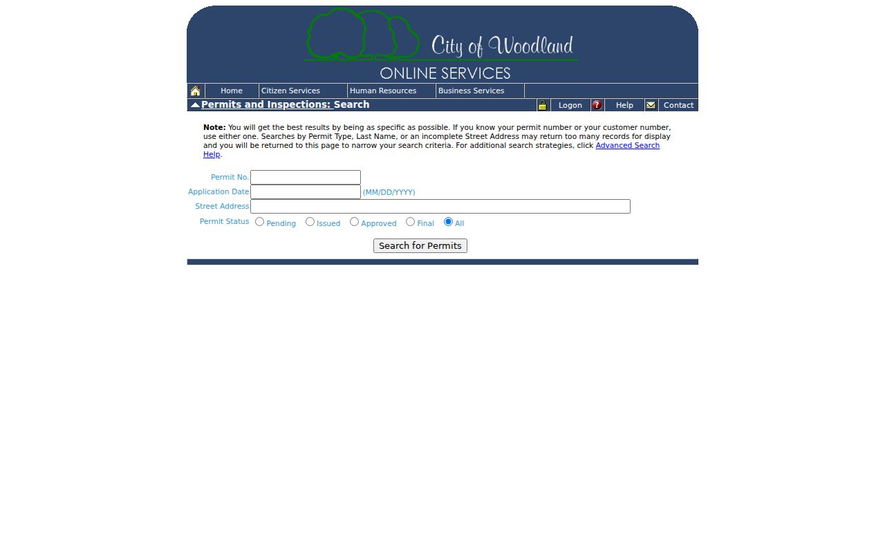
The permit result belongs beside the parcel and deed notes, never in place of them.
Yolo Street ZIP Codes Cross City Lines
A Yolo street directory search can fail when a postal city is treated as the legal jurisdiction. County address points separate Post_Comm, Post_Code, Inc_Muni, county, agency, and USPS_Zip_Verify. The municipality domain contains Davis, Winters, West Sacramento, Woodland, and Unincorporated. Thus 95616 and 95618 reach beyond an intuitive Davis boundary, 95691 reaches beyond West Sacramento, 95694 reaches beyond Winters, and 95695 and 95776 include Woodland and unincorporated areas.
Postal names also cross the county’s mental map. Courtland appears in 95615 even though its postal community lies across the Sacramento River. Dixon appears in 95620 on Yolo land with a Solano-associated postal city. In rural communities, the postal community can differ from the office that controls permits, taxes, or records. Confirm the municipality in GIS before sending a request.
The county address service carries a USPS verification value of verified, not reviewed, or not found in the USPS lookup. The address-point and parcel fields are more useful than a generic ZIP assumption. The captured address schema below helps a Yolo street directory worksheet keep postal and government location in separate columns.
That separation helps route a street record to Yolo County, a city office, or a different postal community without changing the address itself.
Yolo Street History in Directories and Sanborns
The historical side of a Yolo street directory uses a different shelf. Yolo County Archives holds miscellaneous Woodland directories from 1898 to 1975 with gaps and Polk volumes from 1939 to 1999 with gaps. The county’s Sanborn maps cover Woodland locally from 1926 to 1961, while free Library of Congress sheets reach selected years for Davis, Winters, and Woodland, including a 1912 Woodland sheet. A directory can name a person at an address, a census can show an enumeration-day household, and a Sanborn can show a building footprint or use.
Read the sources in alternating years. Preserve the exact surname spelling and any address or street section. If a directory skips a year, do not turn the gap into a move date. A street name can also be printed differently from the modern GIS form. Carry APN, subdivision, lot, and legal description when an address trail becomes uncertain.
The historical directory collections themselves belong to the Yolo city directory page. Current street work belongs here, where the APN, parcel, permit, postal, and deed links stay in view. This is the cleanest way to keep a Yolo street directory specific without claiming that old print volumes behave like a modern address database.
Yolo Street Terms Made Clear
A short definition prevents a street record from carrying more weight than it can bear. These terms recur in the Yolo sources and should stay attached to the record type that produced them.
- Parcel
- A mapped land unit tied to an APN. One parcel can hold several units or households.
- Situs address
- The physical location of the land or structure, distinct from the mailing address used for correspondence.
- Plat
- A recorded or mapped plan that helps identify lots, blocks, or a subdivision.
- Criss-cross directory
- An older reverse directory that may organize a search by address or street when a particular volume includes that section.
- APN
- The assessor’s parcel number, a stable bridge between the address clue, tax roll, map, and related records.
Yolo’s parcel and address services make these distinctions practical. The APN can connect the tax result to the GIS polygon, but the recorder still needs a party or document key. The situs can connect a permit to a place, but the mailing address may point somewhere else.
Privacy Limits on a Yolo Street Lookup
A street directory cannot show every person associated with a parcel. Household members who are not recorded owners, confidential voters, Safe at Home participants, utility customers, delivery-account holders, and DMV subjects do not become public through an address search. A parcel owner may be absent, an entity may hold title, and a mailing address may belong to a trustee or manager. These are ordinary record limits, not clues that a hidden roster exists.
California voter files are available only through the permitted-purpose routes described in Elections Code sections 2187 through 2194. The Yolo voter self-lookup is private and exact match. The state’s Safe at Home program can substitute a mailing address for eligible participants. If a requested record is not online, a CPRA request should name an existing identifiable record, address, date range, and record type. It should not ask the agency to create a list of people.
| Official trail | Secondary compiled tool | Best practice |
|---|---|---|
| APN, parcel, deed, permit, or archive source | May merge names, addresses, and dates from many sources | Verify with the named custodian |
| Defined record type and access rule | Unclear coverage and update timing | Preserve the date and scope |
| Legal and privacy limits are visible | May not explain exclusions | Use only for personal, lawful research |
Lawful use. Yolo address records are for personal, lawful research, family history, and understanding a block. Do not use a street lookup to stalk, harass, intimidate, or harm any person.
The best Yolo street directory result is a documented chain: address to APN, APN to parcel, parcel to an allowed owner or deed clue, and each historical or civic source labeled by what it actually shows.